San Vito lo Capo, the port and country !
info@sanvitolocapo.biz
 San Vito lo Capo occupies a promontory (the “Head”) north-western Sicily that separates the Gulf of Castellammare from the coast of Trapani, near the Zingaro nature reserve to the west and east of Mount Hood.
See a trap no longer active since the seventeenth century, is an ancient fishing village already very important in Roman times (testimony remains in the tanks for fish farming, whose remains are found near the trap of San Vito) and which preserves intact a clear Arabic influence; but it is also the city of cous cous, dish of peace and a symbol of integration between peoples and cultures.
Its turquoise sea has earned several times the European Blue Flag for water quality, and its white beach is considered one of the most beautiful of the Peninsula.
The village of San Vito was born in the vicinity of the shrine dedicated to the saint mazarese, a Saracen fortress which was originally built in the thirteenth century, and around which the first houses began to appear at the beginning of the eighteenth century.
Of Arab-Norman style is also the shrine of Saint Crescentia, whose figure is linked to the patron saint of the country.
The beach of San Vito has restored archeological artifacts are now preserved in the Museum of Sea and coming mainly from the wreck of the Arab-Norman lying on the seabed in front of the lighthouse.
The marina
- Receptions:
- Years. 38° 11′ North – Long. 12° 44′ Is
- Maritime Authority:
- Delegation of beach
- Chorography
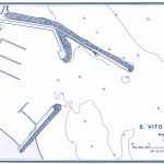
- Located on the west coast and semi-circular sandy bay between Cape S. Vito and Punta Solanto and approximately miles 15 NE of Trapani, the port of San Vito Lo Capo is made of an outer breakwater, Long elbow m. 400 oriented to the east, and on average by a long breakwater m. 180 oriented to NE.
- From the outer breakwater (or the North Pier) branches off into another direction SE m long pier. 90, quay side SW.
- Banchinati are also the first arm of the North Pier and 80 meters of the outer breakwater. The port during the summer period is also frequented by numerous pleasure boats.
- TECHNICAL DATA
- Stretch of water
- 72.300 m. with depths up to m. 8.
- Coastal development
- 1.100 m. referred m. 430 Beach and m. 300 of operational quays.
- MARINA
- Equipped with 6 piers has 400 berths, water, light and night surveillance. Backdrops maximum of ca. 5 mt.
- FACILITIES AND SERVICES
- Lighting, Hydrant, loading and unloading equipment, slipway under construction, buncheraggio, search and rescue (da Trapani), health service, PP.TT., phones, banking service, travel services.
- NUMBERS OF SPECIAL INTEREST
- Dialing Code: +39 0923
- Hall Tel.972253
- Police Tel.972346
- Guardia di Finanza Tel.972230
- VV.FF. Trapani Tel.21073
- Yacht club “Gaia Costa” Tel.972189
- Yacht club “Traina”
- Association recreational “Sanvitese”


